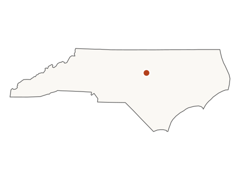
Latest Census city estimates released May 14, 2026 · Population as of July 1, 2025 · Next city estimates scheduled for May 2027. Release schedule
Cary, North Carolina population is 183,582 as of July 1, 2025 (U.S. Census Bureau Vintage 2025 estimate), ranking #145 nationally and #7 in North Carolina. Cost of living runs 1.8% below the U.S. average (BEA RPP 2024); the four-person spending scenario corresponds to modeled gross income of $113,996/yr (TY2026 tax assumptions; partial scenario excluding unverified local income tax). This profile draws on 13 federal datasets covering population, housing, income, employment, climate, and risk.
183,582 people live in Cary as of July 1, 2025 (U.S. Census Bureau Population Estimates Program, Vintage 2025), the #145 largest U.S. city.
How big is Cary?
Cary covers 61.1 square miles of land and 1.1 square miles of water. Its population density is about 3,005 residents per square mile of land. Compare U.S. cities by land area →
Source detail: 2025 population
2025 population
Source agency
U.S. Census Bureau, Population Division
Dataset
Census PEP
Vintage / period
Vintage 2025 (Jul 1, 2025)
Native geography
Census PEP subcounty place records for the included city universe.
Transformation
Copied from POPESTIMATE2025, joined by Census GEOID, and used for ranks, filters, and city pages.
Known limit: Annual estimate, not a decennial count; each new PEP vintage can revise the prior series.
Population grew 5.0% from the April 2020 base to mid-2025.
Vintage 2025 · annual estimates
Recent history (V2025 series, 2020 base → 2025).
2020 base: 174,787 → 2025: 183,582 (+5.0%)
Year
Population
Reference date
2020 base
174,787
April 1, 2020
2020
174,773
July 1, 2020
2021
176,907
July 1, 2021
2022
180,126
July 1, 2022
2023
180,693
July 1, 2023
2024
182,173
July 1, 2024
2025
183,582
July 1, 2025
Earlier history (2010–2019, prior Census vintage)
These figures come from the U.S. Census Bureau’s Vintage 2019 release — a separate, earlier methodology. They’re shown here as historical context only; the 2010 and 2019 values aren’t directly comparable to the 2020–2025 series above.
Population grew 24.2% from the July 2010 estimate to 2019 (V2019 — see seam note below).
Cary is the #145 largest of 19,483 U.S. cities and #7 in North Carolina.
▸Show the analyst detail (9 rows)
Measure
Value
Note
2020 base
174,787
April 1, 2020 census base
5-yr change
+8,795
2020 base → 2025; within V2025
5-yr change %
+5.0%
within V2025 only
1-yr change
+1,409
2024 → 2025 estimate
1-yr change %
+0.8%
within V2025 only
Density
3,005
people per sq mi, land only
Land area
61.1
sq mi (2025 Gazetteer)
U.S. rank by population
#145
of 19,483 cities
State rank by population
#7
of 549 in North Carolina
What is the median household income in Cary?
Same-period U.S. benchmarks: household income $80,734 ± $166; per-capita income $44,673 ± $122. Margins are at 90% confidence. Comparison badges describe point estimates; they are not significance tests.
Median household income is 67% above the U.S. median ($134,905 vs $80,734); 5.7% live in poverty, 6.8 points below the 12.5% U.S. estimate.
Median household income$134,905
US
Cary: $134,905 — 67% above the US median of $80,734.
Scale: 10th–90th percentile of cities with ACS income data; censored rows retained in the distribution
Cary
$134,905
United States
$80,734
Income and poverty estimates for Cary from the U.S. Census Bureau's American Community Survey (ACS) 5-Year estimates (window 2020–2024). Every figure is shown with its 90% margin of error (MOE). Cells where the ± margin exceeds half the estimate are flagged "low precision." See methodology §12.
Measure
Estimate
± margin / note
Median household income
$134,905+67.1% vs US
±$3,712
Per capita income
$67,409+50.9% vs US
±$2,063
Population in poverty
5.7% ± 0.9 percentage points
share of population for whom poverty status is determined
Median home value is 74% above the U.S. median ($580,200 vs $332,700); median rent is 23% above ($1,738 vs $1,413); price-to-income ratio (4.3×) is roughly in line with the U.S. median (4.1×).
Median home value$580,200
US
Cary: $580,200 — 74% above the US median of $332,700.
Scale: 10th–90th percentile of cities with ACS home-value data; censored rows retained in the distribution
HUD 2-BR fair-market rent$1,750/mo
US
Cary: $1,750/mo — 62% above the US median of $1,077/mo.
Scale: 10th–90th percentile of cities with a HUD Fair Market Rent
Same-period U.S. benchmarks: home value $332,700 ± $236; gross rent $1,413 ± $2. Comparison badges describe estimates and do not establish statistical significance.
Poverty (Census SAIPE 2024, model-based), unemployment (BLS LAUS 2025 annual averages), and remote-work share (ACS 2020–2024) for Cary. Numbers are labeled at their native grain — place-grain when BLS publishes it, otherwise per-county. We do not compute population-weighted county averages. See methodology §13.
Measure
Value
Grain
Unemployment rate (annual avg)
3.1%
Cary (BLS sub-state LAUS)
Civilian labor force
101,973
2025 annual avg
Worked from home
36.5% ± 1.4 percentage points+141.6% vs US
share of workers 16+ working from home · U.S. share: 15.1% · ACS
County context — Cary spans 3 counties; all are listed (no weighted average):
County
Poverty rate
Median HH income
Unemployment
Wake County
8.6%
$107,083
3.2%
Chatham County
8.7%
$100,222
3.3%
Durham County
11.3%
$84,375
3.4%
Top industries by private employment — NAICS supersectors rolled up from Cary's linked 3 counties in the U.S. Bureau of Labor Statistics' Quarterly Census of Employment and Wages (QCEW, 2025 annual averages). See methodology §11.
#
Industry (NAICS supersector)
Private employment
Avg weekly wage
#1
Health care and social assistance (62)
85,655
$1,340 / wk
#2
Professional and technical services (54)
81,043
$2,522 / wk
#3
Retail trade (44-45)
66,709
$815 / wk
#4
Accommodation and food services (72)
59,449
$523 / wk
#5
Administrative and waste services (56)
53,101
$1,196 / wk
What workers earn in the Raleigh-Cary, NC metro — top occupations by employment plus six curated benchmarks (registered nurse, software developer, elementary teacher, general manager, retail salesperson, truck driver). Wages are metro-area medians from the U.S. Bureau of Labor Statistics' Occupational Employment and Wage Statistics (May 2025). See methodology §25.
Retail Salespersons is the largest tracked occupation in the Raleigh-Cary, NC metro (18,660 jobs, median $33,100/yr).
▸Show all 13 occupations
Occupation
Employment
Median annual
Median hourly
Laborers and Freight, Stock, and Material Movers, Hand
17,060
$38,470
$18.50
Cashiers
14,350
$29,770
$14.31
Customer Service Representatives
13,620
$41,900
$20.15
Fast Food and Counter Workers
12,790
$29,080
$13.98
Stockers and Order Fillers
12,300
$35,220
$16.93
Cooks, Fast Food
11,500
$28,220
$13.57
Office Clerks, General
11,350
$44,460
$21.38
Retail Salespersons · benchmark
18,660
$33,100
$15.91
Registered Nurses · benchmark
12,780
$84,830
$40.78
Software Developers · benchmark
12,580
$132,770
$63.83
General and Operations Managers · benchmark
9,520
$114,940
$55.26
Heavy and Tractor-Trailer Truck Drivers · benchmark
7,210
$52,110
$25.06
Elementary School Teachers, Except Special Education · benchmark
5,830
$60,170
—
This city spans multiple metros; OEWS data shown is for Raleigh-Cary, NC, the metro of the city's primary county.
All items run 1.8% below the U.S. average (RPP 98.2); utilities run 11.0% below (RPP 89.0) — the metro's utility affordability is the main driver.
Cost of living (RPP, all items)RPP 98.2
US
Cary's cost of living runs 1.8% below the U.S. average (RPP 98.2 vs 100).
Scale: 10th–90th percentile of metro/non-metro areas with a BEA price parity
BEA Regional Price Parity (all items)
RPP 98.2
−1.8% vs U.S. average · BEA 2024 · Raleigh-Cary, NC metro
HUD Fair Market Rent, 2-BR
$1,750/mo
FY2026 · Raleigh-Cary, NC MSA
State income tax (top marginal rate)
3.99%
flat · TY2026
Four-person monthly spending scenario
$9,500/mo
3BR rent + food + childcare + taxes + transport · federal sources; excludes unverified local income tax
One-person monthly spending scenario
$4,048/mo
1BR rent + food + taxes + transport · federal sources; excludes unverified local income tax
Local income tax
—
Unverified and excluded from the spending scenario; not a verified zero
Household budget figures are arithmetic floors using current federal sources at the grains documented in methodology. Not a recommended salary, not a poverty threshold, not a composite score.
23.9% ± 1.1 percentage points foreign-born (U.S. share 14.1%); Other Indo-European is the most-spoken language at home other than English (6.4% of residents 5+).
A quick read on Cary's residents — nativity and languages spoken at home shown above, from the ACS 5-Year 2020–2024. The full demographic breakdown (age, race and ethnicity, household types, and educational attainment, each with its margin of error) lives on the demographics page.
These are K-12 public school districts. Higher education (colleges and universities) is not represented in this dataset.
Public school districts serving Cary, from the NCES EDGE Geographic Relationship Files (GRF25, 2024–25 school year boundaries). The join is many-to-many — large cities often span multiple districts, and one district often serves multiple cities. Sorted primary district first. See methodology §12 for the consolidated-city fallback and Milford CT special case.
Source: NCES EDGE GRF25 · school year 2024–25 · methodology →
What is the climate like in Cary?
Hottest month: July (90°F avg high). Coldest: January (31°F avg low). Annual precipitation: 47.9 in.
30-year climate normals (1991-2020) for Cary from the U.S. National Oceanic and Atmospheric Administration. See methodology §15 for the gridded vs. station source path.
Average monthly highs & lows · 30-year normal (NOAA 1991–2020). Every number on this chart is an average.
bar = avg daily high → avg daily lowprecip in inches below each barprecip in millimeters below each bar
Composite risk spans 67.2–95.5/100 across 3 counties; most-cited top hazard is Hail (in 1 of 3).
Natural-hazard exposure for Cary from the U.S. Federal Emergency Management Agency's National Risk Index (FEMA NRI December 2025 v1.20.0). NRI is an expected-annual-loss composite calibrated on 1996–2019 historical losses, published at the U.S. county grain. See methodology §17.
Cary spans 3 counties. We list each separately because hurricane, flood, and fire risk varies meaningfully across county lines — manufacturing a single “city-level” risk score would hide that signal.
County
NRI composite
Rating
Top hazards
Wake County
95.5
Relatively High
Hail 98.5 Relatively High · Riverine Flooding 97.7 Relatively High · Heat Wave 96.9 Relatively High
Source: FEMA National Risk Index · FEMA NRI December 2025 v1.20.0 · methodology →
How fast is home internet in Cary?
11 non-satellite ISPs serve the area; 87% of locations have gigabit-capable service per ISP filings.
Fixed broadband availability for Cary from the U.S. Federal Communications Commission's Broadband Data Collection (BDC), as of December 31, 2025. Every speed and provider count below is an ISP-reported advertised maximum — not measured throughput. Actual delivered speeds typically run 60–80% of advertised. See methodology §16.
Measure
Value
Note
Providers serving this city
11 + satellite
distinct ISPs, excluding satellite-only
Fiber providers
11
offer fiber-to-the-premises somewhere in the BDC
Units with ≥100/20 Mbps fixed
100.0%
share of broadband-serviceable units, ISP-reported max
Locations with ≥100 Mbps upload
87.0%
derived: max(fiber ≥100/20, gigabit). Fiber is symmetric; gigabit is ≥100 up by definition
Units with ≥1 Gbps fixed
87.0%
share of broadband-serviceable units, ISP-reported max
Total broadband-serviceable units
78,906
residential locations in the FCC Fabric (not households)
Source: FCC BDC · as of December 31, 2025 · methodology →
How much crime is reported in Cary?
In 2024, law enforcement reported 129 violent and 2,395 property offenses in the Cary jurisdiction — a violent-crime rate of 71.0 per 100,000, below the U.S. estimate of 359.1.
Reported offenses known to law enforcement from the FBI Uniform Crime Reporting Program (CIUS Table 8), 2024. Figures describe the FBI agency jurisdiction: Cary — an FBI jurisdiction population of 181,793, versus the Census place population of 183,582. The rate per 100,000 is the FBI's own (count ÷ that jurisdiction population), never divided by the Census place figure. These are reported crimes under voluntary participation — not measured or victimization crime — and the FBI cautions against using them to rank or compare places. See methodology §31.
Offenses known, 2024
Count
Rate /100k
U.S. rate
Violent crime
129
71.0
359.1
Property crime
2,395
1,317.4
1,760.1
▸Offense breakdown and 3-year trend
Offense, 2024
Count
Murder and nonnegligent manslaughter
3
Rape
12
Robbery
23
Aggravated assault
91
Burglary
161
Larceny-theft
2,019
Motor vehicle theft
215
Arson (12-month reporters only)
8
Year
Violent /100k
Property /100k
Jurisdiction pop.
2022
79.5
1,105.8
178,600
2023
103.9
1,230.9
182,878
2024
71.0
1,317.4
181,793
Only years the agency reported a complete 12 months appear; the FBI does not estimate missing agency-years, so a gap is a non-reporting year, not zero crime.
U.S. rate is the FBI national estimate (imputes non-reporting agencies); the city figures are reported-only. Source: FBI UCR CIUS Table 8 (2022–2024) · FBI agency jurisdiction: Cary · methodology → · FBI Crime Data Explorer →
In-state context.
Cary sits at state rank #7 among 549 cities in North Carolina. Nearby in the state ranking:
Just above in the profiled set: Elk Grove, CA · #144 · 185,007 residents.
Just below in the profiled set: Newport News, VA · #146 · 183,230 residents.
Quick travel facts for Cary
Quick travel facts.
Elevation
380 ft · at city centroid, from USGS 3D Elevation Program
Nearest scheduled-service airport
Raleigh-Durham International Airport(RDU) · 7 mi 11 km from city centroid
Best months to visit
Apr, Oct · months when the avg high sits in 65–80°F and precipitation is at or below the city's median monthly precip
Sources: elevation from USGS 3DEP · nearest airport from OurAirports CSV (OurAirports type=large/medium and scheduled_service=yes; not an FAA service classification) · best months derived from NOAA 1991-2020 normals · methodology →
Frequently asked questions about Cary.
How many people live in Cary, NC?
Cary has 183,582 residents as of July 1, 2025, making it the #145 largest city in the United States and #7 in North Carolina. Source: U.S. Census Bureau Population Estimates Program, Vintage 2025.
Is Cary growing or shrinking?
Cary has grown 5.0% since the April 2020 census baseline, adding 8,795 residents, including a 0.8% increase from 2024 to 2025. Source: Census PEP Vintage 2025.
Cary spans Wake County, Chatham County, Durham County in North Carolina.
How big is Cary?
Cary covers 61.1 square miles of land, with a population density of about 3,005 residents per square mile. Source: Census Gazetteer 2025.
What is the median household income in Cary?
$134,905, about 67% above the U.S. median. Source: ACS 5-year estimates, 2020–2024.
SourceU.S. Census · PEP
VintageV2025
Reference2025-07-01
Place typeIncorporated place
GEOID3710740
Last build2026-09-30
Sources · provenance
Every listed dataset is used on this page.
The GEOID for Cary is 3710740. These are the official datasets used by this profile's main data modules; click "methodology" for inclusion rules and the V2019 ↔ V2025 seam, or "source" for the raw publisher page. The headline population value above includes a source-detail disclosure with publisher, dataset, vintage, native geography, transformation, and caveat.